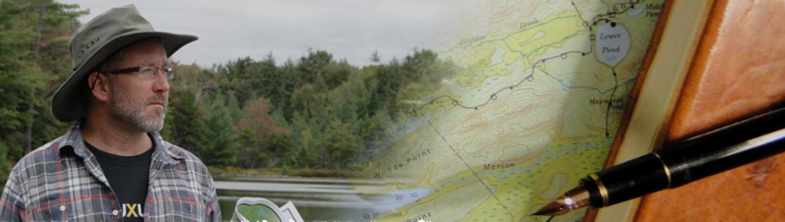
It is one of the most prevalent misperceptions that the purpose of maps is to show you how to get from one place to another. They do serve that purpose, of course. But more importantly, they seduce you into exploring places about which you'd otherwise never have known.
I can understand the lure of GPS units: I use them too, navigating and learning the streets of big cities. And it's tempting to have a battery-operated unit in your hiking backpack that shows you your location in the mountains with a reassuring precision (assuming your unit has batteries, and your bag hasn't fallen into a river, and ...). But when it comes to coaxing you away from home and into new adventure, I find GPS units fail roundly. Just gaze at a big map you've posted on your wall some cloudy morning while you drink your coffee, and see if your boots don't start tapping.
Continue reading "For the Love of Maps"
In 1995 I found myself – to my surprise – back in the Hamptons for a summer. And what a lovely summer it was.
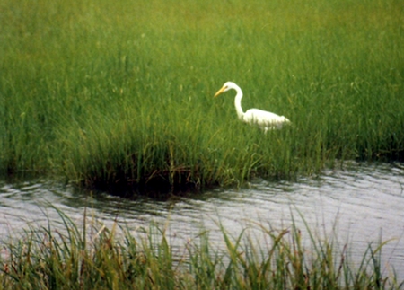
With neither job nor job prospect, I spent a lot of late spring and early summer down on the shore armed with a pair of binoculars and the good sense to stay quiet. Here's some of what I saw pecking around at the edge of the Atlantic:
Continue reading "Shorebirds of Long Island"

November, 1992: I’d just copied this from The Prophet, by the Lebanese poet Kahlil Gibran:
“And forget not that the earth delights to feel your bare feet and the winds long to play with your hair.”
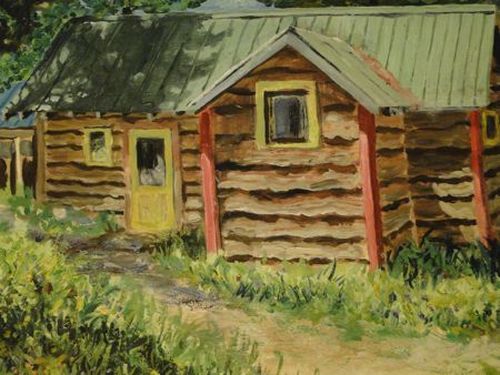
The correct way to test that hypothesis, obviously, was via a grueling, 50 mile hike through the Adirondacks’ High Peaks region. And as the autumn entered its wan, second half, that’s what we did.
The moon was full the evening before we entered the Adirondack park, after - as usual - a long drive northward and eastward from Ithaca, and a night stuffing as much of Dave’s mom’s fantastic cooking in our bellies as we could. Autumn was becoming early winter, but what we wanted wasn’t green canopy over our heads, but the perfect isolation of wilderness, and a chance to soak in the scents and sounds of the world. With boots laced up and bags strapped on our backs, we set off walking through birches that looked yellow and tired, and set our sights on the far side of the empty woods. Leaves were still falling, but there was more color pooled around our feet than over our heads. Above us, the empty boughs conspired to let in the light of the late autumn moon.
 Continue reading "Cold River and Moose Pond: Traverse of the High Peaks Wilderness"

This is a list of birds I spotted in Lititz, Pennsylvania, between June 1994 and March 1995. Not much else remains for me of that long, cold winter. But I do remember the leaves around the lake turning auburn in the fading light of summer, the glass-like warble of the Hermit Thrushes in the forest stand behind the house, the Barn Swallows turning circles in the air, and the acrobatics of the Fly Catcher.
Such is life: a few things we carry with us, but most of it we don't. And time alone is the judge of what mattered and what didn't. Keep singing, little birds. Keep singing.
The picture is of a tree in which a family of Screetch Owls had nested – so amazing to see them peering out at me.
Continue reading "Bird List: Lititz, Pennsylvania"
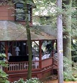
We spent six nights on Fourth Lake in the southeastern Adirondack Mountains, a trip comprised of several hundred miles' travel, as well as about 60 years' time travel back to an age that ended before I ever knew it.
You could hardly hope for a more lovely get-away than the Viking Village on the south shore of Fourth Lake, closer actually to the hamlet of Inlet than to Old Forge. Through a dark fringe of pines and spruce, the broad, still waters of the lake reflected the morning sunlight and then evening stars in turn. Mornings, the coffee tasted better in the cool, mountain air, and before turning in we'd kindle wood fires in the fire pit, roasting marshmallows and listening for black bears or the rustling of the raccoon. Some nights we had neighbors in the other cabins, and a few nights we were practically alone out there. And as I explored the land and then the facilities it became clear we were glimpsing another world.
Continue reading "Six Nights on Fourth Lake"
There are a lot of things I learned to love about Pennsylvania the year I lived there: the broad fields of deep, rich soil and the Amish farms that seem to have to limit to their production. The way the locals call it "P A", and the endless tables of starchy, white food. But that's just the view from Lancaster County, and this enormous state is full of surprises. One of them I found just down the road from me.
Mount Gretna is nestled just south of the first folds of the Alleghany Mountains, in a strip of forest flanked by plowed fields as though the disks had just separated a bit in passing. It would've remained unknown to me had relatives not chosen to retire there. And it amazes me to this day.
Continue reading "Mount Gretna"
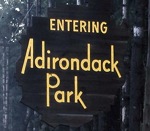
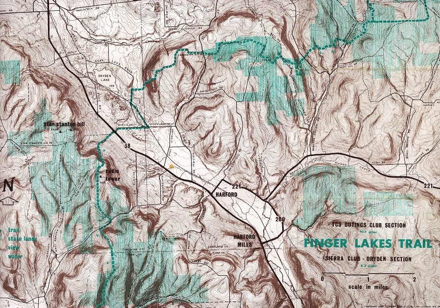
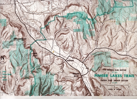
In the early 1990s, I associated the Adirondacks with freedom almost indiscriminately. Upstate New York was my stomping ground, and when I tired of the Fingerlakes, real wilderness awaited just a few hundred miles to the northeast. In the Adirondacks you could truly get away from the raging masses, classwork, and society. You could get yourself off the map. Hell, you could even get hurt.. That was its beauty, and I loved it. Amazing, then, that it took me another sixteen years to return. The lesson here is that there is absolutely no telling where life will take you.
Continue reading "The Adirondacks, Sixteen Years Later"

I returned from Indonesia in the summer of 1994, and spent a lonely year in an unlikely place: Lititz, Pennsylvania. That I would find myself in Pennsyvlania was unexpected, but this quiet corner of Amish Country was lovely and enchanting. It was Speedwell Forge, an artificial lake built in the 1960s and the well-loved fishing hole of a generation of Central Pennsylvanians. More than once I canoed around its perimeter, scouring its surrounding hillsides for signs of deer and searching in the wetlands for Heron and Ibis. This is one of very few pictures I took that year, but I recall it fondly: early fall in the treetops, and the glassy water's surface.
Continue reading "Speedwell Forge: the magical disappearing lake"

The Adirondack forest looks different when you're not hiking a blazed trail, when the trees crowd in on all sides, when nothing is worn before your footsteps, when your destination is out of sight and will remain so until the final moment. By the time we emerge from forest and climb the last hundred meters to the rocky peak we're soaked, but it's worth it: the view of Blue Mountain Lake and the nested ridges of Adirondack forest trailing off over the horizon is lovely – and for me, unprecedented. I look at Dave, who has gotten an idea, and following his gaze I get my compass out of my bag's top pocket. It's a straight shot down to nearby Tirell Pond (and then the trail), but there's no trail leading there. We're going to hike the old way, using our backwoods skills, our intuition, and by dipping into our reservoir of luck.
Continue reading "Tirell Pond"
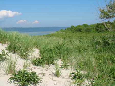
Grassy and solitary on Moriches Bay’s wintery horizon, the island beckoned to me like tapping on the windowpane. On paper, too, it intrigued. I traced its perimeter with a finger on the 1956 topographic map. An inconspicuous sand patch just behind the barrier beach in the shallow waters of Moriches Bay, the unnamed island was just close enough to the inlet to challenge the skills of a circumnavigating small boat sailor, but still close enough to home to be reachable in an afternoon sail. And it had no name at all, just the intersection of latitude and longitude in the shadow of the more prominent Swan Island a couple hundred meters west and across the channel.
Continue reading "Not Swan Island"
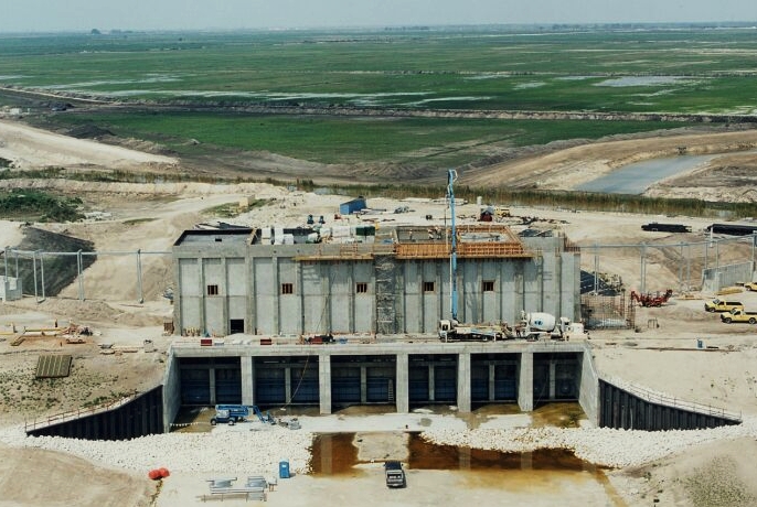
I spent 2002 and 2003 working on the Corps of Engineers' ambitious Everglades
Restoration Project, as a Construction Representative at Pump Station 362. It's part of a massive effort to improve the chemical characteristics of the stormwater inflow to the Everglades from the Loxahatchee area. The following are some thoughts on the Everglades and some pics of the wildlife that shared my workspace while I was there.
Continue reading "Pump Station 362"
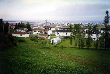
The inter-island ferry deposited me on the docks in late afternoon, and I had to scramble to find a campsite and set up my tent before night fell. Clouds had rolled in from the ocean on a wet wind and the temperature was dropping. "It's not the temperature," everyone told me, "it's the wind." I got my first sense of just what they meant that first night in my sleeping bag, when my little tent was buffeted by winds that would have carried it out to sea had I not been lying inside. The Mi'qmak Indians got it right centuries ago when they named the place "Menagoesenog," the Windswept Islands.
Continue reading "Autumn's Cusp on the Windswept Islands (Les Îles de la Madeleine)"
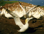
The literature from the local chamber of commerce all pointed me to Roche Percé (“ Pierced Rock”), the photogenic monument standing off the coast of the Gaspé peninsula. Indeed, Percé’s high arch permitted small boats to sail right through what could only have been a monument to the struggle of forces that defines nature and humankind. But my own map was leading me farther afield to Île de Bonaventure.
Continue reading "Île de Bonaventure"
The adventure began with a map. All the best ones do. All the maps of America I’d grown up with had shown Maine as the northeastern terminus of land, the limits of civilization, the promontory from which you could look out over the cold waters of the North Atlantic. And maps of North America showed Canada and the United States in such a way that the sheer mass of Quebec overshadowed the land north of Maine. But “Atlas Plate 20: Eastern Canada, May 1967” made me catch my breath.
Continue reading "Land's End at Gaspé: A Quebécois Adventure"