Almadies: the Westernmost Point in Africa
For as long as I've looked at the "Africa" plate in the atlas, Senegal has drawn my attention, and in particular, that point in Dakar where the land stretches westward into the Atlantic, drawn into a point. It's the Presqu'Ile of Cap Vert, better known as Dakar, and it's as far west as you can go on the continent of Africa. It's the end of the world, or the beginning.
In my imagination, Cap Vert was low and sandy, somewhat desolate, with broad, watery horizons on all sides. I was way off. Much of Dakar rises above the Atlantic in rocky cliffs, with steep escarpments and broad promontories. Very little of it is sandy. Furthermore, it was clearly volcanic in a prehistoric time: deep cuts into the earth's surface reveal dark stripes of volcanic ash, and all the rocks have a "cooled lava" look to them. Perhaps oceanic currents spilling along the coastline pulled the sand out along the point now called Cap Vert.
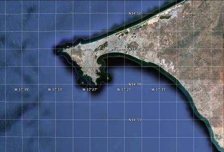
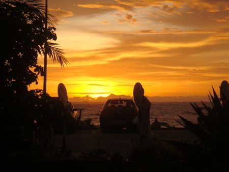
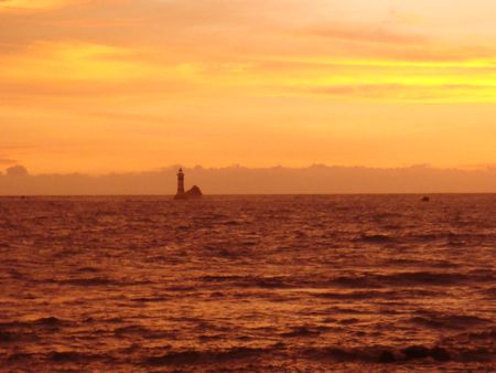
Dakar's western-most point isn't far from our home, and we can be there in minutes. It's called Pointe des Almadies. What's the "end of Africa" look like? There's a clutch of restaurants set around a cul-de-sac, and a view westward to a lighthouse set on rocks, at the edge of roiling currents over the reef. Here's where the African day comes to an end.
The name Almadies is a bastardization of Al Mahdi (![]() approximately, "the prophet" or "the chosen one") Apparently, the man who carried Islam to Senegal from the Maghreb settled near here, and the French transformed the word into the name for the region, pluralizing it in the process. The blend of Arabic and French, Islam and Christianity, the beginning and the end of Africa. This is our new home.
approximately, "the prophet" or "the chosen one") Apparently, the man who carried Islam to Senegal from the Maghreb settled near here, and the French transformed the word into the name for the region, pluralizing it in the process. The blend of Arabic and French, Islam and Christianity, the beginning and the end of Africa. This is our new home.
Trackbacks
The author does not allow comments to this entry
Comments
Display comments as Linear | Threaded